Discovering the Otterburn Military Ranges: Northumberland's Wildest, Best-Kept Secret
Updated: Aug 2
I've hiked, driven and motorcycled across the Otterburn Military Ranges in pretty much every direction over the years, and it's still the one part of Northumberland where I can spend an entire morning or afternoon out there and not see another soul.
That's not an exaggeration. Ninety-plus square miles of open moorland, woodland and craggy hills sitting right in the southern Cheviots, and most visitors to Northumberland don’t bother to set foot on it. Not because there's nothing here. Because a line of red and white signs and the words "Ministry of Defence" send most people straight back to the car.

I get it; it can look a bit intimidating, and I’m ex-military myself. But once you understand what those signs actually mean, this becomes one of the best places in the whole county to disappear for a day.
Yes, you really can go in; it's permitted, in fact it’s encouraged by the MOD
The Otterburn Ranges are split into two zones. The Open Access Area is exactly what it sounds like: walkable all year round, no live ammunition, and open to anyone. The Controlled Access Area is where live firing takes place, and this is the bit that closes when red flags or lamps are showing.
GOV.UK publishes a firing calendar for Otterburn and other ranges every month, but the way it is presented has changed recently. Following the government's Strategic Defence Review, the Army is training at a higher readiness level than before, so the published calendar now just shows the daily windows when live firing is permitted across the estate, rather than specific pre-booked slots the way it used to.
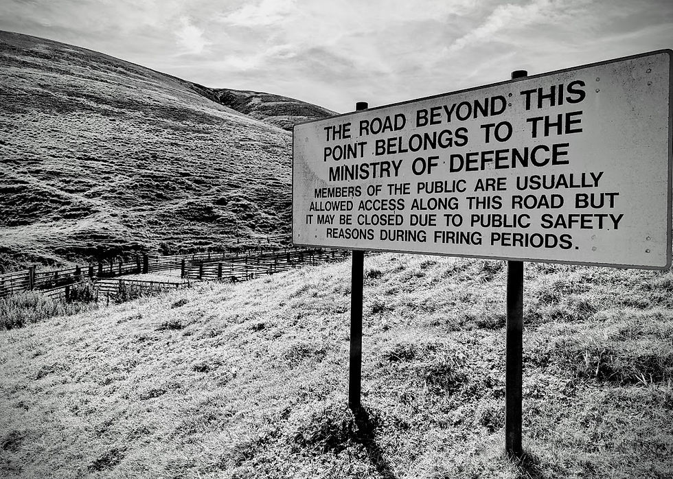
So basically that means the published times tell you firing COULD happen at some point in that window, not that it definitely will. This does make it a little bit harder to plan ahead now, but the one signal that always tells you in real time is the red flags. No red flags flying, no lamps lit, you're free to walk the marked roads, footpaths and bridleways. It really is that simple, and it's the same rule I've followed out there for years, before I began checking the website. In reality, the times when the ranges are active for live firing, out of a full 52 weeks of the year, are still only a small percentage.
The MOD have a published PDF that confirms all of the above; you can download it from the link below for your own peace of mind.
Otterburn General Access LR
Getting out into the Otterburn Military Ranges: Where to start from
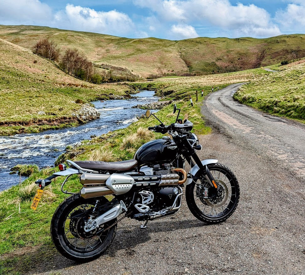
There are a few brilliant places to actually get onto the ranges, and where you choose changes the whole flavour of the day. Alwinton, right at the top of Coquetdale, is one of my regular starting points. Once you're through the village, the road narrows to a single track heading up towards the range boundary, and it gets properly potholed and gravelly in places. If you're on a road-style motorcycle, this probably isn't your best way in. Adventure bikes and scramblers, on the other hand, will eat this stretch up without a second thought. The scenery here is pretty dramatic too; you’ll not be disappointed.
You can begin your adventure with a look around Alnwinton village. The old church is gorgeous, set against a stunning backdrop of the hills as you look down on it from the churchyard.
In Alnwinton, you have The Rose & Thistle Pub that does awesome breakfasts, a great way to start your day, loaded up on delicious butchers' sausages, black pudding and even haggis!!
You’ll also find Clennell Hall just a short walk from the village; they do cracking pub food and a good Sunday lunch too. The old hall has a lot of history; it's a lovely place. They also host regular live music events and have a campsite.
Clennell Hall is just a short walk from Alwinton for a great Sunday Lunch
Holystone is another favourite, and it comes with a bonus. Holystone sits just outside Harbottle, and right next to the village is Lady's Well, easily one of the most peaceful spots in the whole county, worth a visit in its own right for the history and the photographs alone. The story goes that in Easter week of AD 627, the missionary bishop Paulinus baptised three thousand Northumbrians in these waters, a claim carved into the stone cross that still stands at the centre of the pool. Paulinus is said to have knelt on the flat stone at the well's edge that "Holystone" took its name from.
In the twelfth century, an Augustinian priory of nuns dedicated to the Virgin Mary owned the well, and that's where the name "Lady's Well" originated.
For a time it even became a wishing well, with pins and coins thrown into the water for luck.
On many occasions when I've visited, there have been coins left on the flat stone at the head of the pool, including coins from around the world placed by international visitors to the area.
Lady's Well at Holystone, such a peaceful and tranquil setting with stunning views.
Holystone Wood is right there too, criss-crossed with paths through the trees, and it's hugely popular with dog walkers. The bluebells are spectacular in the spring too.
Elsdon offers access to the ranges about a mile before the village when approaching on the road from Rothbury; you’ll see the gate and signage clearly as you drive over the moors. Personally, I prefer to head up onto the ranges and get my hiking in. Then after a good walk or motorbike ride, pop into Elsdon to grab some food or even just a coffee and cake at the Bird in Bush. It’s a beautiful pub, very welcoming. It has a great little coffee shop serving cakes and sandwiches as well as a full pub menu served in the restaurant bar or their lovely courtyard.
The Bird in Bush pub, Elsdon
Elsdon is a great village to explore; very picturesque and has a lot of history behind it. The village was once the capital of Redesdale and was a frequent target of the infamous Border Reivers. On one raid in 1584, the Reivers killed 14 men and took 400 prisoners, as well as making off with 400 horses and another 400 cattle.
It has a beautiful church built around 1400 and dedicated to St Cuthbert, whose body is said to have rested here for a short time in 875, during the wanderings of the Monks of Lindisfarne.
Elsdon Church with its interesting gravestones
At various times through the ages, the church was used to garrison soldiers. On the pillars nearest the entrance, you can find deep grooves made by the fighting men as they sharpened their weapons. The graveyard has many old and unusual graves which date back to the Victorian and Georgian eras, including some interesting and creepy-looking grave motifs; it’s worth hunting them out.
Redesdale is the fourth option, entering just past The Redesdale Arms, a 600-year-old former bastle house better known locally as the "First & Last," since it's the first or last inn on the road to Scotland depending which way you're heading.
Their Sunday lunches are excellent, and there's a café right next door for cake and sandwiches if you're after something lighter. A few miles further on is the Kielder Forest Drive, another brilliant off-road route I'll cover properly in its own blog.
Great food at The Redesdale Arms, awesome Sunday lunches
What you'll actually find out there
This is the bit people never expect. The Ranges aren't just empty moorland, though there's plenty of that too. You've got proper woodland to walk through, wide open heather moors, hills worth the climb for the view alone, and a genuine network of bridleways and public footpaths heading off in every direction. Some of the loneliest, most scenic roads in Northumberland cut straight through it, the kind of tarmac that makes a motorbike ride feel like something out of a film.
If gravel or adventure biking is more your thing, there are tracks out here that will keep you entertained for a full weekend without repeating a single mile.

Then there's the landscape itself. Panoramic views that run for miles with barely a building in sight, dramatic sandstone crags rising out of the heather, and wildlife that has the place almost entirely to itself. I've stood on hilltops out here where the only sound was wind and the odd curlew, with not another person for as far as I could see in any direction.

The history and what happens on the ranges
The Otterburn Training Area was established in 1911, which means it's been in continuous use for well over a century, predating the Northumberland National Park itself by 45 years. It covers around 93 square miles, roughly 23% of the entire National Park, and somewhere in the region of 30,000 soldiers train here every year.
The range of weapons used gives you a sense of the scale. Everything from 5.56mm small arms right up to AS-90 self-propelled artillery trains here, and Otterburn is the only place in the entire UK where the M270 Multiple Launch Rocket System can be fired, a weapon that needs an 11-mile-long, 2-mile-wide range just to do its job safely. The soft ground across most of the estate rules out heavy armour like main battle tanks, but everything short of that has trained here at some point. When the big guns do fire, sometimes the windows in my house vibrate, and I'm about 10 miles away.

Long before any of that, this was Roman ground too. Dere Street, the Roman road built north from York in the first century AD, cuts straight across the ranges, and the remains of Roman marching camps still survive at Chew Green.
Nature and wildlife
Given how few people pass through, it's no surprise the wildlife thrives. Curlew, skylark and ravens are common overhead, and you've a good chance of spotting merlin, buzzards and black grouse if you're patient. Herds of feral goats roam the heather along the border ridge; most people don't expect wild goats in Northumberland. Red squirrels and deer are regular sightings too.
Down along the River Coquet you'll see herons fishing, and dippers walk the riverbed hunting insects. The Ministry of Defence's own conservation work has grown barn owl numbers across the estate farms too, which is something you wouldn't expect on a live firing range. I do love barn owls. You'll see numerous white-faced Cheviot sheep grazing the hills or just wandering along the road, minding their own business in no hurry to move out of the way of your car. You'll still spot the old circular stone stells dotted about, built to shelter them through winter.

Myths, legends and the border history from around this area
This stretch of Northumberland has a dark history if you know where to look.
Winter's Gibbet, not far from Elsdon, near Harwood Forest, marks the spot where William Winter's body was hung in chains in 1791 after he murdered a seamstress at nearby Raw Farm.

Up on Windy Gyle, Russell's Cairn, originally a Bronze Age burial mound, takes its current name from Lord Francis Russell, shot dead there in 1585 during what was supposed to be a truce meeting between English and Scottish border officials.
This was Border Reiver country too. For roughly 300 years this borderland was ruled as much by family feuds, with raiding parties moving cattle and settling their scores by the sword.
Smugglers later used the same roads to move contraband whisky past the excise men, and the remains of a few old illegal stills can still be found.
Smugglers would pop across the border to Scotland, where the excise duty on whisky was considerably less, then they'd fill their carts and return to Northumberland under cover of darkness. In 1803 the duty on whisky in Scotland was three shillings per gallon, but a few miles down the road in Northumberland the English crown was taxing it at eight shillings a gallon to help fund the Napoleonic wars. So a good smuggler could earn a decent profit selling the Scottish-purchased whisky in Northumberland.
You'll also come across surviving bastles, small fortified farmhouses built to withstand a night raid, dotted here and there across the landscape if you know where to look.
Border Ridge a fantastic walk out in the wild borderlands
Trails worth discovering
For anyone wanting a proper route rather than just wandering, the ancient trackways make for some of the best walking or gravel riding on the estate. Dere Street itself is a fantastic long route with big ridge views into Scotland, and Clennell Street and The Street offer similar drover's-road walking through remote country. The Pennine Way runs along the border ridge close by too. If you fancy something shorter, the walk up to Darden Lough takes you past Fell Sandstone crags and heather thick with bilberries, a proper reward of a view for a relatively modest climb. The hill lough itself is pure black because of the peat, and it retains the heat too, if you dip your feet in the waters.
Useful information before you go
Two zones: Open Access (walkable year-round) and Controlled Access (closed when red flags or lamps are showing)
Always check the current firing calendar on GOV.UK before you go, but treat red flags as the final word, not the calendar
Range Control: 01830 520569, call if you're ever in doubt
Never touch or pick up anything you find lying on the ground
Take rubbish home with you, leave no trace, but leave with memories
I'll be honest, part of me doesn't want too many people reading this. The whole appeal of the Otterburn Ranges is that almost nobody goes. But that's exactly why it deserves a place in our Northumberland 250 Adventures Book, and why I keep going back myself, year after year, on foot, on the bike, and behind the wheel.
Come and join us. Find more reading material
If you enjoyed this, come and join our helpful and friendly Facebook Community here.
For a copy of our official Northumberland 250 Adventures Guidebook, visit our homepage, where you can purchase both paperback and digital versions, ready for your next adventure.
To learn more about the Borderlands part on the Northumberland 250, check out our borderlands blog and discover our must-visit recommendations.
You never know, I might just see you over the ranges.
Happy adventuring,
Jeff


Comments